Astromaterials Research & Exploration Science
METEORITE FALLS
DATE/TIME3/26/2003 @ 11:50 PM3/26/2003
|
LAT/LONG41.487994 • -87.679289
41.487994
|
This meteorite fall was one of the largest meteorite falls recorded to date in weather radar imagery. The fireball occurred at 11:50 PM local time on 26 March 2003, or 05:50:15 27 March UTC. The fireball was reported as very bright with numerous reports of intense sonic booms through the southern suburbs of Chicago, IL. This meteorite fall pre-dates the American Meteor Society’s online fireball reporting system and so no AMS number is recorded for the event.
Meteorites have been recovered from this event. Two scientific papers were written to describe this meteorite fall in detail, reachable at these links:
Brown et al 2004 (https://onlinelibrary.wiley.com/doi/pdf/10.1111/j.1945-5100.2004.tb00075.x)
Simon et al 2004 (https://onlinelibrary.wiley.com/doi/pdf/10.1111/j.1945-5100.2004.tb00925.x) Incredibly, the author of this paper is a meteoriticist (e.g. meteorite scientist) whose home lay in the strewn field for this meteorite fall.
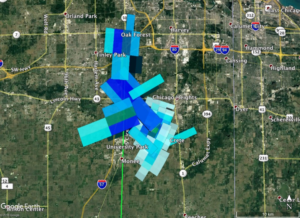
Signatures of falling meteorites can be found in imagery from six nearby weather radars. In the NEXRAD weather radar network operated by NOAA, the KMKX (Milwaukee, WI), KIND (Indianapolis, IN), KIWX (Ft. Wayne, IN), KILX (Lincoln, IL), KLOT (Chicago, IL), and KGRR (Grand Rapids, MI) radars record signatures of falling meteorites.
The first appearance of falling meteorites on radar occurs at 05:50:16 UTC and 15,520 m above sea level (ASL) in the 05:46 UTC data set for the KMKX radar in the 4.2 degree elevation radar sweep. This radar sweep is unusually intense for a meteorite fall and appears to be a cluster of many meteorites of a wide range of masses that was detected within ~1s of the fireball terminus. The meteorites in this radar signature have not had time to size-sort on the way to the ground so an average mass cannot be reliably calculated, but it gives a very useful measurement of the fireball terminus time and altitude. Signatures consistent with falling meteorites appear in a total of twelve radar sweeps from the six radars, with a final signature appearing at 05:57:39 UTC.
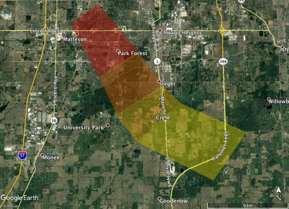
This meteorite fall is used as a benchmark for estimation of meteorite fall mass using weather radar imagery. There are several reasons why: this was a large meteorite fall, it was observed by a large number of radars, it occurred in densely populated suburban terrain so the meteorite recovery rate was high, and it is generally a well-known meteorite fall in the meteor and meteorite research communities. Meteorites from this fall damaged several houses and a fire station. More about Park Forest meteorites and damage caused by the fall can be found here: (http://www.psrd.hawaii.edu/Aug04/ParkForest.html).
The fragmentation behavior of the Park Forest fall is typical for an average meteorite, based on comparison with other meteorite falls seen in weather radar data.
A large number of meteorites were recovered from this event, and they have been classified by the Meteoritical Society as an L5 chondrite.