Imagery Integration plays a central role assessing launch vehicle and spacecraft performance, as well as supporting public outreach, for human exploration beyond low earth orbit.
For human lunar exploration, NASA is relying on several major programs: The Orion Multi-Purpose Crew Vehicle (MPCV), Space Launch System (SLS), Deep Space Gateway (DSG), Human Landing System (HLS), Exploration Ground Systems (EGS), and lunar surface systems. Each of these programs will utilize carefully designed engineering- and scientific-class imagery systems to monitor and analyze vehicle and system performance as well as support geologic exploration of the Moon. It is important to note that both the Challenger and Columbia accidents were initially detected and diagnosed with imagery. Engineering class imagery systems do far more than collect pretty pictures, they are carefully calibrated data acquisition systems capable of observing features and events beyond the ability of traditional instrumentation (strain gauges, temperature sensors, etc) to detect. ARES direct support to all these programs and activities comes in the form of Imagery Integration.
Imagery Integration
Imagery Integration is the organized effort to define operational concepts, requirements, mission support plans, and participant interactions for the integrated engineering imagery system for all lunar exploration elements. To accomplish this, the Joint Engineering Team for Imagery (JETI) has been established to coordinate the imagery activities for Orion, SLS, EGS, HLS, DSG, and lunar surface. At JSC, ARES’ role is to lead the Orion Imagery Integration team - administratively managed by the Orion Imagery Working Group (OIWG) - and provide Orion imagery leadership and expertise to JETI on behalf of the Orion Program.
Engineering Imagery
Engineering imagery is the class of high-quality imagery (both motion, and still) that is collected for the specific purpose of monitoring the performance of the integrated system. In this case, the system comprises Orion (spacecraft and crew systems), SLS (launch vehicle), EGS (launch pad and ground support systems), DSG (cislunar habitation and science), HLS (lunar lander), and lunar surface systems (rovers, surface habitats, etc.). Imagery may be in native digital format or acetate film that is later digitally scanned to facilitate detailed measurements. (Yes indeed, there are still some applications where traditional film out-performs digital.) The purpose of making detailed measurements (i.e., photogrammetry) from imagery is to ensure proper operation of the integrated system and verify the safety of the crew and success of the mission. Engineering image analysis is performed within ARES by the Image Science and Analysis Group (ISAG).
A question is often asked, "Why use cameras to make measurements? Why not just instrument the vehicle?" The key advantage of engineering imagery is capturing the unexpected events - the unknown unknowns. Returning to the examples of Challenger and Columbia, you could never have installed enough strain gauges, temperature sensors, or other means of collecting direct measurements in a cost effective way to catch every possible booster burn-through, debris release, or miscellaneous system anomaly. Cameras and high quality imagery systems allow you to collect time-correlated data over a wide range of locations on the vehicle. And to report all that information, Imagery Integration is the process by which a consolidated, systematic story - synthesizing all elements across a human mission - can be communicated to mission management.
Scientific Imagery
Scientific remote sensing and high-resolution / multispectral imaging systems will play a key role in the ongoing geologic exploration of the Moon. And while Imagery Integration does not directly influence the principal investigators’ needs for proposing a particular instrument or research topic, it can directly assist by helping to coordinate Program requirements and operational concepts needed to integrate scientific imagery systems into overall mission planning.
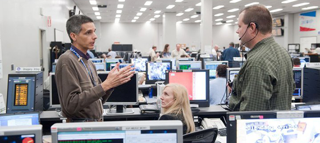 MISSION SUPPORT: Imagery Integration is much more than a pre-flight planning effort. During the mission, imagery experts monitor vehicle operations, discuss potential anomalies, and report findings that may impact the success of the mission or safety of the crew to mission management. Credit: NASA.
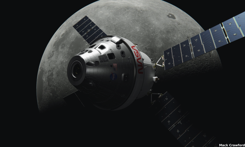 ORION SPACECRAFT: NASA’s newest spacecraft designed for deep space exploration. Orion will take astronauts farther than ever before beyond Earth orbit. Credit: NASA.
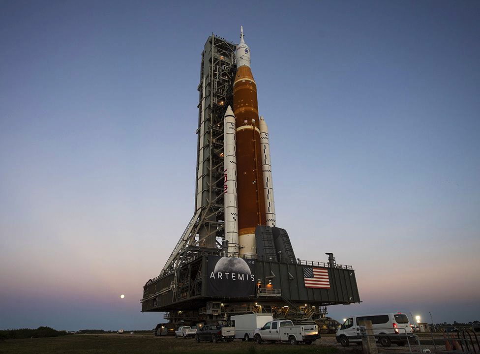 SPACE LAUNCH SYSTEM: To carry Orion and other deep space exploration payloads off the Earth, NASA requires the prodigious lift capability of SLS.
Credit: NASA.
SPACE LAUNCH SYSTEM: To carry Orion and other deep space exploration payloads off the Earth, NASA requires the prodigious lift capability of SLS.
Credit: NASA.
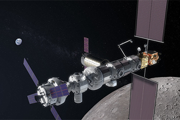 DEEP SPACE GATEWAY: To facilitate regular exploration of the lunar surface, the Deep Space Gateway will be assembled in lunar orbit and periodically visited by Orion carrying the next generation of planetary explorers.
Credit: NASA.
DEEP SPACE GATEWAY: To facilitate regular exploration of the lunar surface, the Deep Space Gateway will be assembled in lunar orbit and periodically visited by Orion carrying the next generation of planetary explorers.
Credit: NASA.