Astromaterials Research & Exploration Science
METEORITE FALLS
DATE/TIME6/20/2026 @ 0008 UTC6/20/2026
|
LAT/LONG45.939476 • -83.324361
45.939476
|
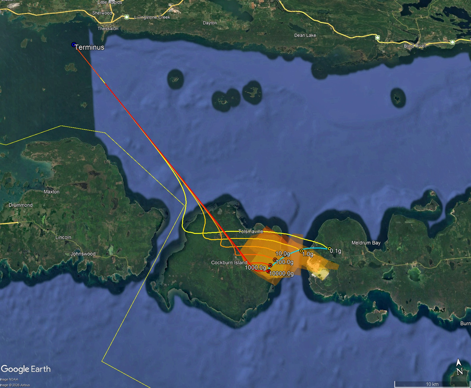
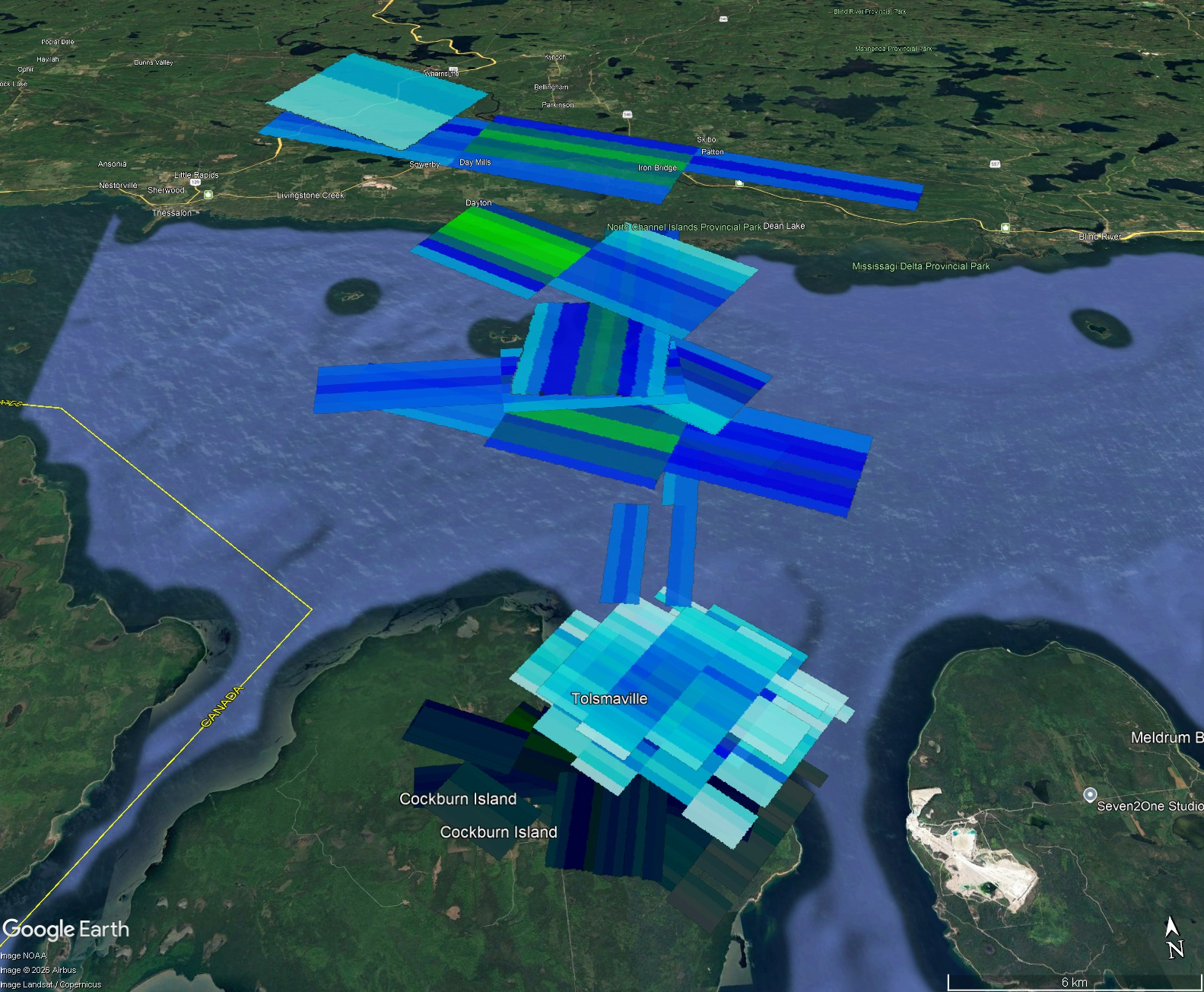
Update (22 June 2026): Strewn field map added here. Winds at the time of the fall ranged up to 30 m/s (67 mph) but changed direction by 90 degrees around 20 km altitude. The resulting flight paths of falling meteorites are almost a spiral, with a high concentration of meteorites landing in a small area centered on the road passing through approximately 45.9225 -83.2893. Basically, meteorites landed on the eastern end of the island. Some very small (>1g) meteorites landed in the dolomite quarry across the lake.
The flight paths shown here are for hypothetical meteorites. Just because there is a 10 kg meteorite shown on the map does not necessarily mean there is a 10 kg meteorite on the ground.
Signatures of falling meteorites are seen in eighteen radar sweeps from four different NEXRAD radars. High reflectivity values indicate this was a relatively high mass fall.