Astromaterials Research & Exploration Science
METEORITE FALLS

DATE/TIME8/14/2026 @ 07:48:36 UTC8/14/2026
|
LAT/LONG47.828035 • -119.365966
47.828035
|
This event occurred at 12:49 AM in central Washington state. It appears in Geostationary Lightning Mapper (GLM) imagery from both the GOES East and GOES West NOAA weather satellites. The NASA Meteoroid Environment Office estimates its power as equivalent to approximately 10 tons of TNT with a relatively high altitude terminus of 54 km.
The KOTX (Spokane, WA) radar in the NOAA NEXRAD national weather radar network records two signatures consistent with falling meteorites in the 07:44 UTM radar data volume, in the 3.96 and 5.05 degree radar tilt sweeps. Total radar detection time is very short at only 2 minutes 25 seconds, but this may be a consequence of limited radar coverage in the area.
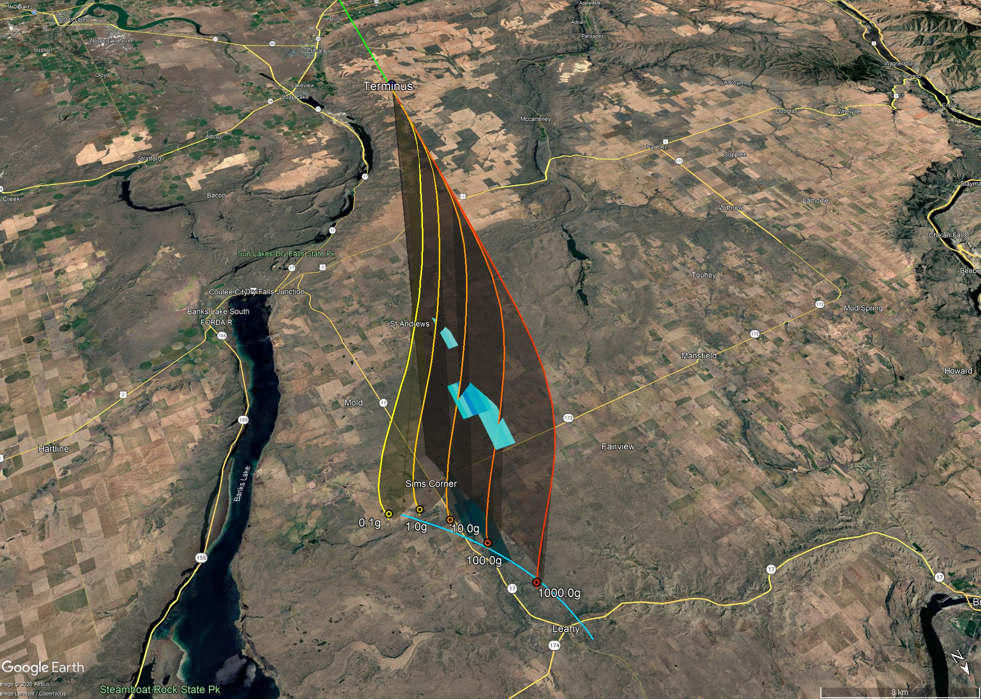
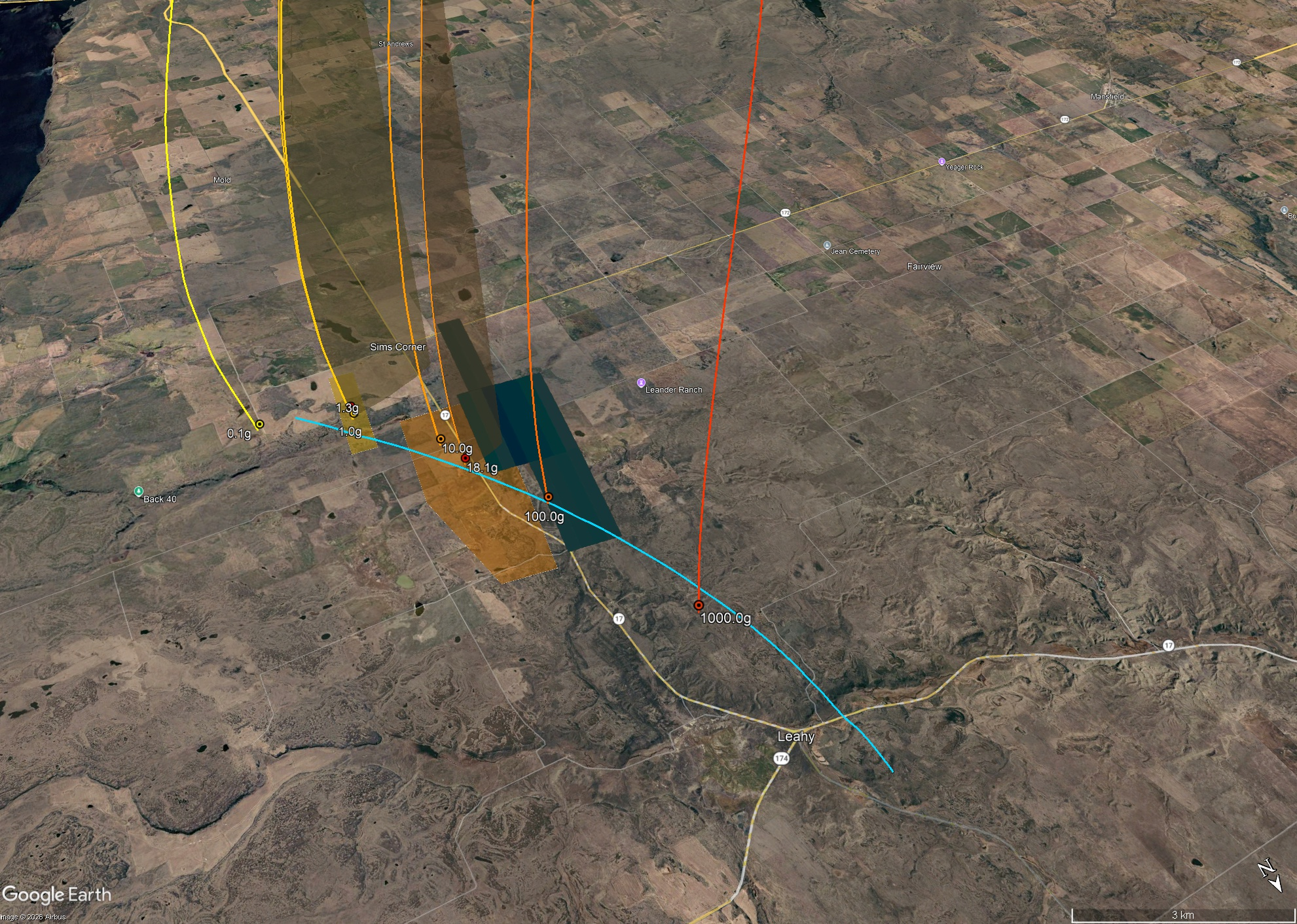
The Jormungandr2 (J2) dark flight model indicates that the strewn field roughly follows the WA 17 road, just north of Sims Corner, WA. This is a low mass fall as evidenced by the sparse radar detections.