ESP develops strategies and technologies for successful human exploration of other planets, trains astronauts in surface exploration, and provides support throughout the mission, from start to end.
ESP develops strategies and technologies for successful human exploration of other planets, trains astronauts in surface exploration, and provides support throughout the mission, from start to end.
ESP develops strategies and technologies for successful human exploration of other planets, trains astronauts in surface exploration, and provides support throughout the mission, from start to end.
A strategic approach to science operations is through ESP’s provision of analog
mission environments. Analog environments are terrestrial sites, virtual reality,
augmented reality or a combination to provide elements comparable to an astronaut’s
space experience. They serve as a backdrop for scientific investigations, technology
testing and rehearsal of operational frameworks for exploration.
ESP leverages these environments to train astronauts in conjunction with classroom
training in geosciences and exploration. Additionally, ESP partners with flight
controllers during missions to provide feedback to astronauts on exploration progress
and scientific findings, adjusting mission plans in response to discoveries and issues.
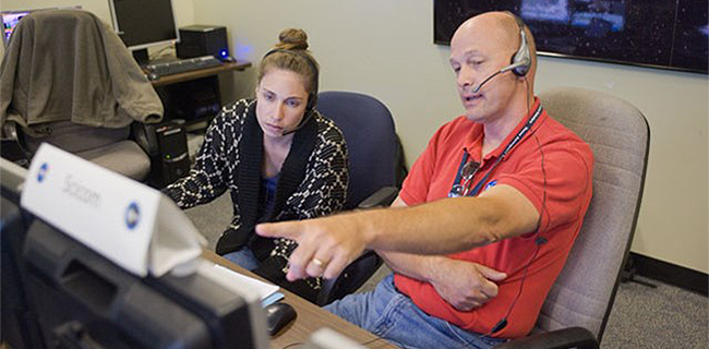 Future Focused: Scientific expertise is used to design mission objectives and support mission execution.
Future Focused: Scientific expertise is used to design mission objectives and support mission execution.
Future Focused: Scientific expertise is used to design mission objectives and support mission execution.
NEEMO
The NASA Extreme Environment Mission Operations (NEEMO) program uses the Acquarius Reef Base off of Key Largo, Florida for training, science, and technology development. NEEMO is a 16 day mission with a focus on coral reef studies and establishing a new coral reef nursery with university partners.
ARES scientists are leading the integrated science operations for the mission which
highlights Extra Vehicular Activities (EVAs) for coral reef studies, testing of EVA
tools, joint robotic and EVA operations, and the assessment of EVA planning.
ARES will also be developing and testing astronaut training and field note "cue cards",
testing EVA tool stowage and transportation, new geologic sampling tools, and habitat
workstation tools. This year, our science team is also integrating new GIS based mapping
and traverse planning tools. This unique image data set integrates space imagery, regional
data, seafloor topography, and on-site photography.
To learn more about NEEMO, go to
nasa.gov/mission_pages/NEEMO/
To follow NEEMO on Twitter, go to
twitter.com/NASA_NEEMO
To learn more about NEEMO, go to
nasa.gov/mission_pages/NEEMO/
To follow NEEMO on Twitter, go to
twitter.com/NASA_NEEMO
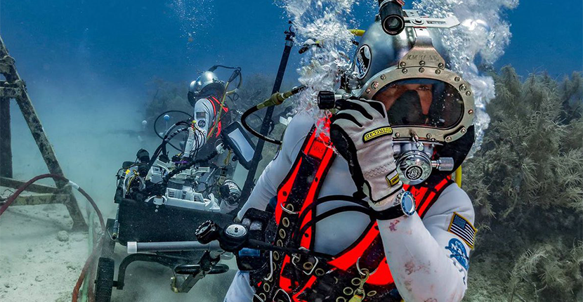 NEEMO Underwater Training: Exploration methodology and techniques are
developed through the use of analog environments.
NEEMO Underwater Training: Exploration methodology and techniques are
developed through the use of analog environments.
NEEMO Underwater Training: Exploration methodology and techniques are
developed through the use of analog environments.
NEEMO Underwater Training: Exploration methodology and techniques are
developed through the use of analog environments.