Astromaterials Research & Exploration Science
METEORITE FALLS

PRESCOTT, AZ

PRESCOTT, AZ

PRESCOTT, AZ

DATE/TIME

2/16/2020 @ 14:17 UTC

2/16/2020
14:17 UTC

LAT/LONG

34.717562 • -112.747969

34.717562
-112.747969

This is an estimated landing site map for this fall, color coded according to mass. Red is kg-mass meteorites, scaling down to yellow single-gram stones.

STREWN FIELD

This is an estimated landing site map for this fall, color coded according to mass. Red is kg-mass meteorites, scaling down to yellow single-gram stones.

SUMMARY

This event was a probable meteorite fall that occurred at 7:17:29 AM local time on 16 Feb 2020, or 16 Feb 2020 14:17:29 UTC. Events are recorded as “probable” if they produce well-defined signatures of a meteorite fall in weather radar imagery at the time and place described by eyewitnesses, but no meteorites have been recovered from the event to date. The fireball was an especially loud daytime bolide which left a lingering smoke trail. Sixty-nine eyewitnesses reported it to the American Meteor Society across Arizona. Eight eyewitnesses reported hearing sonic booms from the falling meteorites. Radar evidence of the fall is sparse, but the few radar signatures found provide reasonable evidence that a fall occurred based on velocity and other data product signatures.

Meteorites have not been recovered from this event.

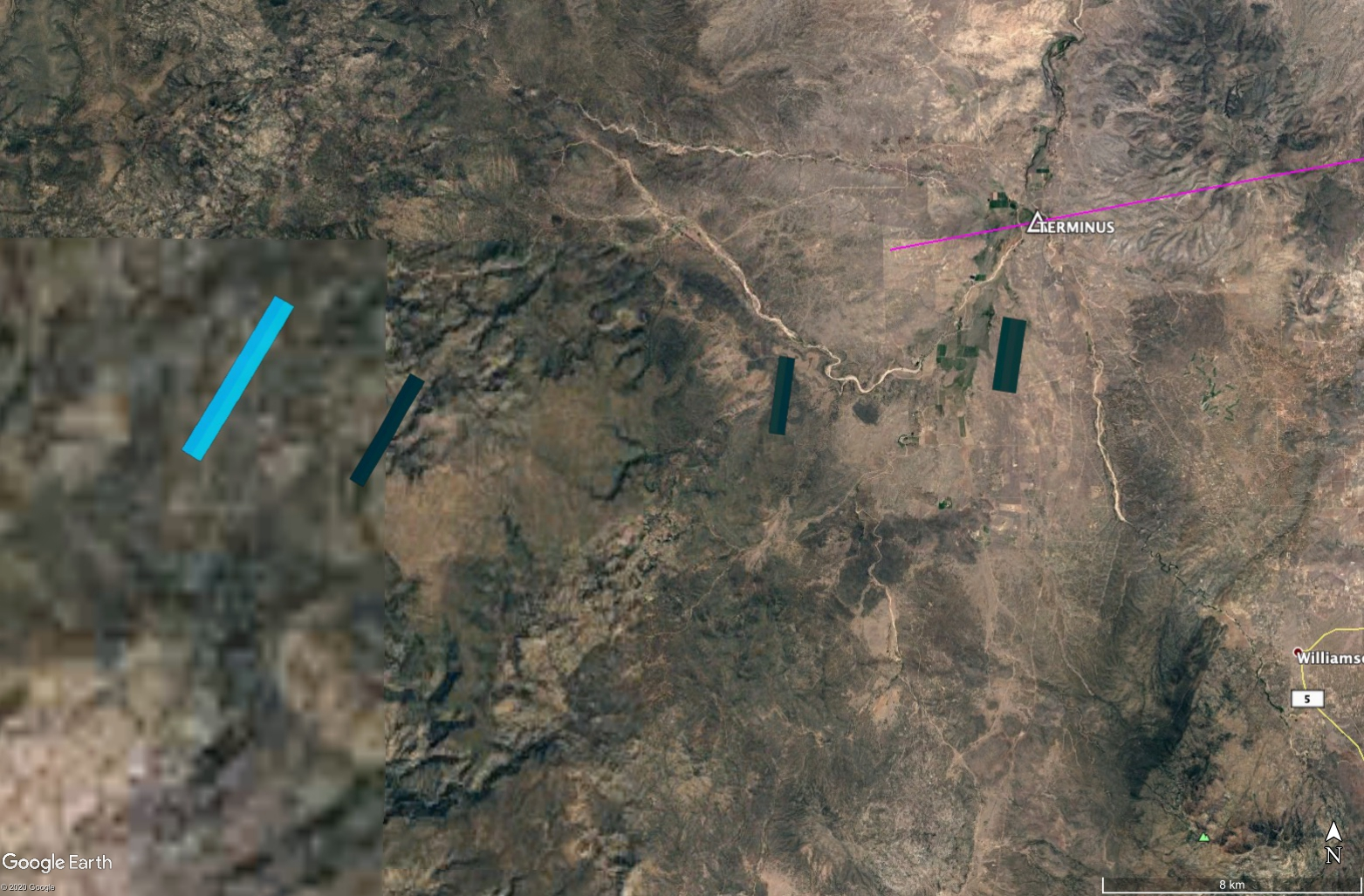
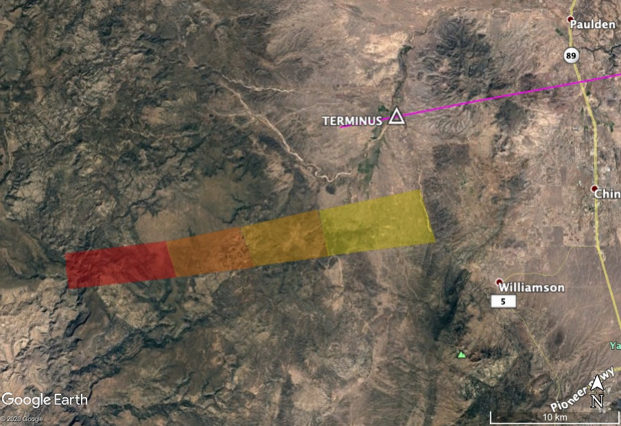
This event is recorded as American Meteor Society event number 795 for 2020. Signatures of falling meteorites can be found in imagery from one nearby weather radar with certainty, and possibly from two more. In the NEXRAD weather radar network operated by NOAA, the KFSX (Flagstaff, AZ) and possibly the KESX (Las Vegas, NV) and KIWA (Phoenix, AZ) radars record signatures of falling meteorites.

The first appearance of falling meteorites on radar occurs at 14:18:58 UTC and 16,400 m above sea level (ASL) in the 1413 UTC data set for the KFSX radar in the 3.12 degree elevation radar sweep. Signatures consistent with falling meteorites appear in a total of possibly seven radar sweeps from the three radars, with a final signature appearing at 14:38:40 UTC. This final return appears a full twenty minutes after the event and may be fine dust.

LEARN MORE

RADAR & MAPS

This composite image shows all the radar signatures from falling meteorites as blue/gray polygons.

RADAR SUMMARY

This composite image shows all the radar signatures from falling meteorites as blue/gray polygons.

GET DIRECTIONS

Click on the View larger map link that is displayed in the address box above in order to get directions to the strewn field area.

EVENTS TO DATE

Learn more about other fall events and possible landing sites that have been identified across the United States.

EVENT UPDATES

Find out more about recent searches and possible discoveries that have taken place around the United States.

METEORITES 101

This step-by-step guide will show you how to locate possible meteorite fall sites using radar software and weather data along with info provided by reporting agencies and monitoring systems.
These instructions will show you how to best preserve the meteorites you discover and how to make contact with the organizations that are willing to accept and analyze your find.
Don't know exactly what a meteorite is, what they are made of or where they come from? If that's the case, we have provided a mini-"crash" course in what you need to know about them.
It turns out that meteorites have provided us a lot of scientific insight, not only into the origins of our solar system and planet Earth, but what the future might hold for mankind.
There's a lot going on in the study of meteorites, both here at NASA and in other places. Here are a few links to the people and institutions who are leading the research in this field.
This website is best viewed in landscape mode on tablet devices.
THANK YOU!
This website is best viewed in portrait mode on mobile devices.
THANK YOU!
This website is best viewed in portrait mode on mobile devices.
THANK YOU!