Earth Science and Remote Sensing Unit
The Earth Science and Remote Sensing Unit (ESRS) provides operations and science team functions for handheld camera crew photography of Earth from the ISS, interacts with other ISS sensor teams and working groups, and coordinates ISS remote sensing response to natural disasters and other dynamic events through interaction with the United States Geological Survey (USGS). The group was traditionally composed of subject matter experts in remote sensing, planetary science, geology, geographic information systems (GIS), and imagery analysis. Machine learning capabilities were added in 2017 to address the growing need for automated image and feature tagging. The diverse capabilities of the group have led to close collaborations with the Image Science and Analysis group, planetary science groups, and other Earth science groups at JSC and agency wide.
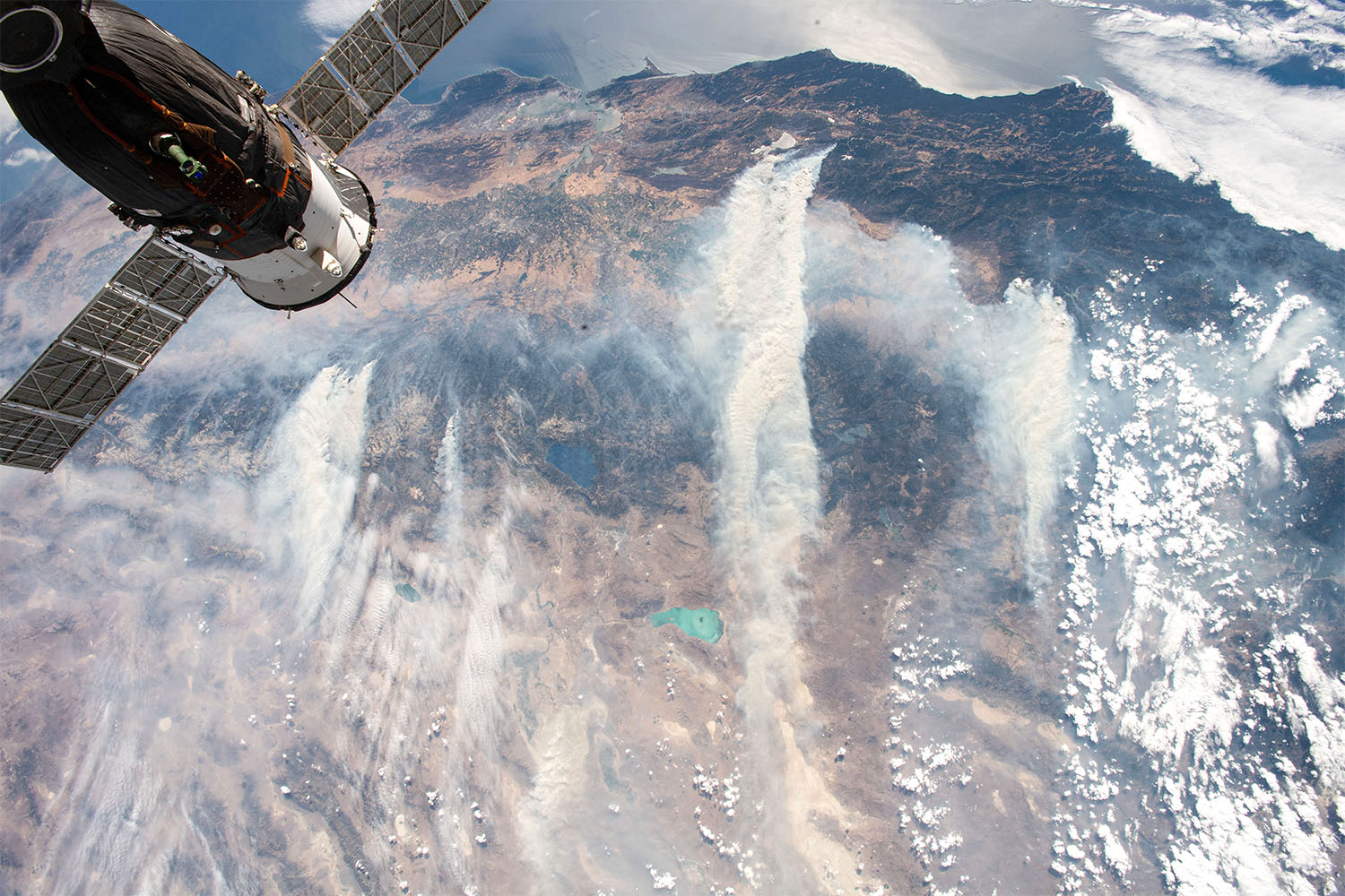 CALIFORNIA FIRES: [ISS056-E-126708] In July and August 2018, towering plumes of smoke have risen from several fires in northern California. Photos of wildfires like the image above aid in disaster response. Scientists can also use the images to study the smoke plumes and the spreading of noxious gases and particles.
Please visit The Gateway to Astronaut Photography of Earth to search our database and find out more about ESRS, CEO, and astronaut photography.
Crew Earth Observations
Astronauts have used hand-held cameras to photograph the Earth for more than 40 years, since the early Mercury missions beginning in 1961. The continuous images taken from the ISS ensure this record remains unbroken. Today, the International Space Station (ISS) continues the NASA tradition of Earth observation from human-tended spacecraft.
In Crew Earth Observations (CEO), crew members on the International Space Station (ISS) photograph the Earth from their unique point of view in low Earth orbit. Photographs record how the planet is changing over time, from human-caused changes like urban growth and reservoir construction, to natural dynamic events such as hurricanes, floods and volcanic eruptions. The images can be used as educational and research tools, as well as historical records of global environmental change, special geological and weather events, and the growth and change of human-made features such as cities. Additional capabilities of CEO include high-resolution night-time imagery of urban and suburban areas, and time-lapse sequence imagery of atmospheric phenomena such as airglow and aurora.
Worldwide access to images captured by astronauts on ISS is available through the Gateway to Astronaut Photography of Earth Web site. The website also features searchable access to all the photographs and a public cataloging facility.
ESRS Areas of Expertise
- Support CEO payload
- Respond to and support the International Disaster Charter activations with georeferenced astronaut photographs
- Train astronauts and astronaut candidates in Earth science and field geology
- Remote sensing support of astronaut field training
- Regional remote sensing in the Houston area
- Manage 4+ million astronaut photo database, the Gateway to Astronaut Photography of Earth (GAPE)
- Improve GAPE with machine learning
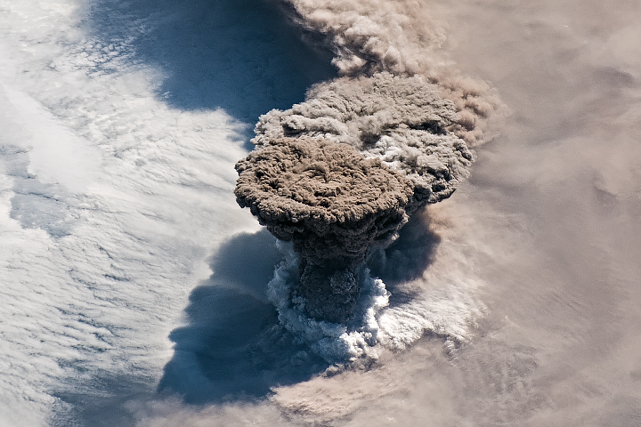 RAIKOKE ERUPTS: [ISS059-E-119250] An unexpected series of blasts from a remote volcano in the Kuril Islands sent ash and volcanic gases streaming high over the North Pacific Ocean on June 21, 2019.
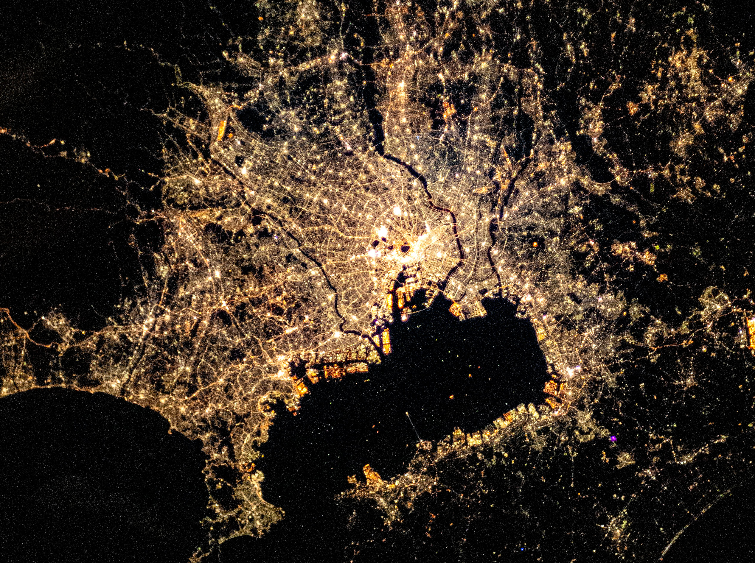 TOKYO AT NIGHT: [ISS064-E-37584] An image of the city of Tokyo at night taken by crew aboard the International Space Station. Scientists have used images such as this one in studies demonstrating the effects of artificial light on urban wildlife and research on the proximity of urban greenspaces to residential areas.
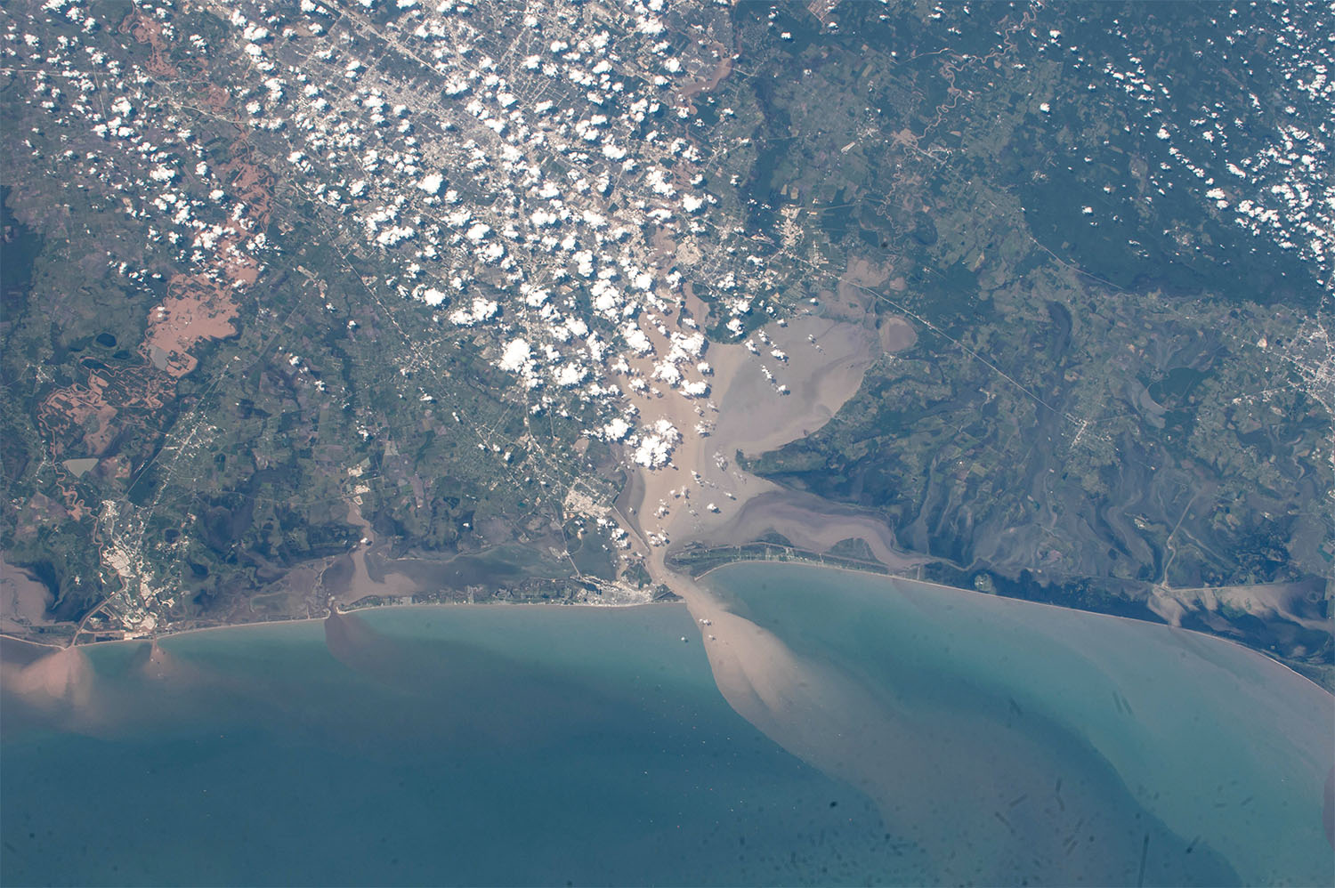 HURRICANE HARVEY: [ISS052-E-78913] Texas rivers and bays are loaded with sediment and mud following Hurricane Harvey. Along the coast, muddy, sediment-laden waters from inland pour into a Gulf of Mexico that also was churned up by the relentless storm.
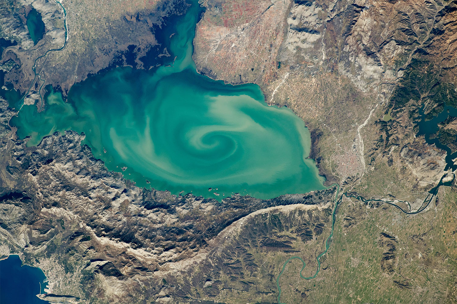 LAKE SKADAR: [ISS062-E-40353] The largest lake on the Balkan Peninsula is colored by sediments eroded from the surrounding highlands.